- Summits
- Flåm Railway
- Route
Flåm Railway · the line in detailThe route
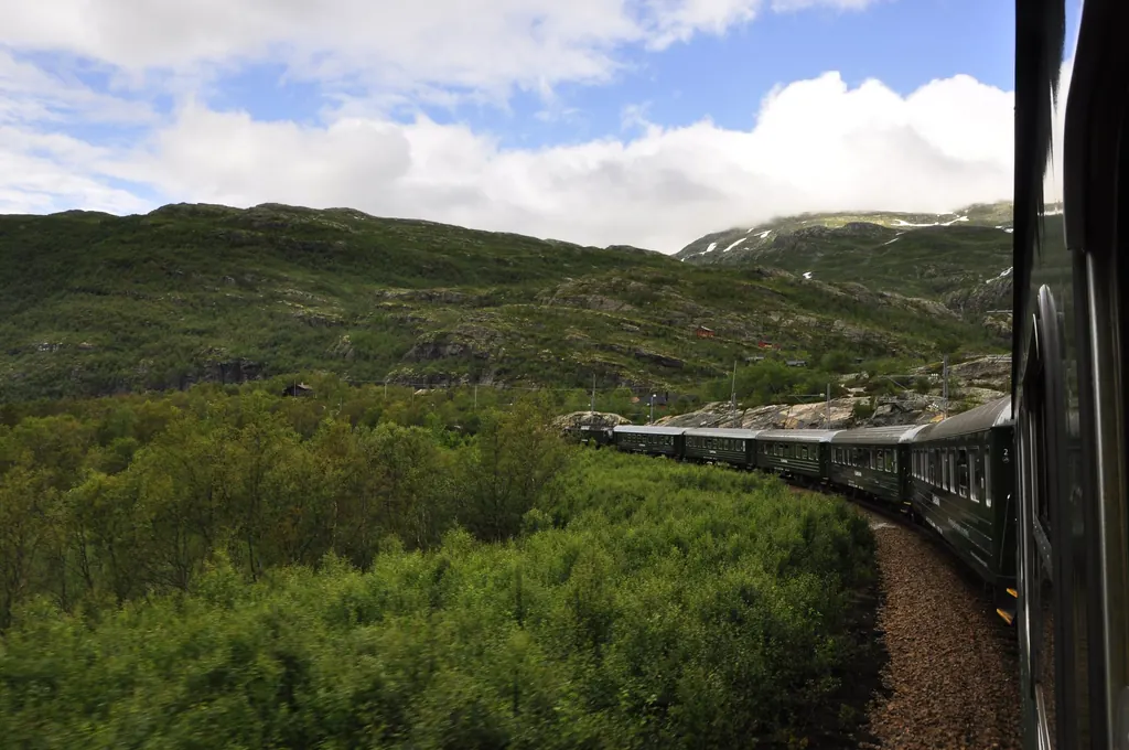
Twenty kilometres, 865 metres of climb, no rack rail. The Flåm Railway (Flåmsbana) gains its height with tight curves, twenty tunnels and a U-turn inside the mountain. Here is what you see where along the way.
- Flåm 2 m
- Berekvam 344 m
- Kjosfossen 670 m
- Vatnahalsen 811 m
- Myrdal 867 m
- Gradient
- 55 ‰
- Tunnels
- 20
- Tightest radius
- 130 m
- Built
- 1923–1940
Checked on 21 September 2026 · Sources: Flåmsbana AS, Norway’s best, Bane NOR · Photo: Karen, CC BY 2.0
Flåm Railway route map: the elevation profile
An ordinary map shows little of this railway – the valley is narrow and the line winds over itself within it. The view from the side tells you more: distance from Flåm to the right, elevation upwards, all nine stations plotted to scale.
You can see it: the first three kilometres are almost flat – as far as Håreina the train gains less than 50 metres. Then the ramp begins. The operator gives 55 per mille for most of the line, that is one metre of height for every 18 metres travelled; Norway’s best speaks of 5.5 per cent on 80 per cent of the length. With radii down to 130 metres, the curves are very tight for a standard-gauge railway.
The Flåm Railway stations with elevations
| Station | What is there | km from Flåm | Elevation |
|---|---|---|---|
| Flåm | Station on the Aurlandsfjord, ticket counter, lockers, museum | 0 | 2 m |
| Lunden | Wooden platform by the river Flåmselvi | 1.6 | 16 m |
| Håreina | by the old village centre with the church from 1670 | 3.0 | 48 m |
| Berekvam | Passing loop halfway along, trains cross | 9.7 | 344 m |
| Blomheller | Stop by the Melhus farm | 11.8 | 458 m |
| Kjosfossen | Photo stop at the waterfall, 5 minutes | 16.1 | 670 m |
| Reinunga | Plateau by the lake Reinungavatnet | 18.0 | 767 m |
| Vatnahalsen | Mountain hotel, start of the zipline | 19.1 | 811 m |
| Myrdal | Change for the Bergen Line, no road | 20.2 | 867 m |
Not every train stops everywhere of its own accord. Stops marked with an “x” in the timetable are request stops: if you want to get off, tell the train crew; if you want to get on, stand clearly visible on the platform.
Flåm to Berekvam: first along the river, then up the valley wall
From the station on the fjord the track first follows the river along the valley floor. Beyond Lunden it starts to climb the side of the valley, and you look down on the old village centre of Flåm with its church from 1670. After the Furuberg tunnel you see the Rjoandefossen waterfall on the opposite side of the valley.
Then the railway crosses the valley on a large embankment; the river runs through a tunnel beneath it. High up on the slope to the left cling the mountain farms Ryo, Holo and Geisme, further up the valley the Vidme farm. At Berekvam, at 344 metres and almost exactly halfway, is the only passing loop. In summer the trains cross here – the points are set by hand, and because only one track has a platform, only the passengers of one train at a time can get on and off.
Berekvam to Kjosfossen: the gorge
Beyond Berekvam the valley narrows. The track presses into the slope close above the rapids, passes through a series of short tunnels and switches sides of the valley again on a second embankment. The view is now on the right. Between two long tunnels the view opens down to the Kårdal farm and the Kårdalsfossen waterfall.
After the Nåli tunnel, the longest on the line, the train has quite literally climbed the steep wall. From here you can see what comes next: snow sheds on three levels one above the other, right at the top a section of the Bergen Line – and beside it the old construction road, the Rallarvegen, zigzagging up the Myrdalsberg.
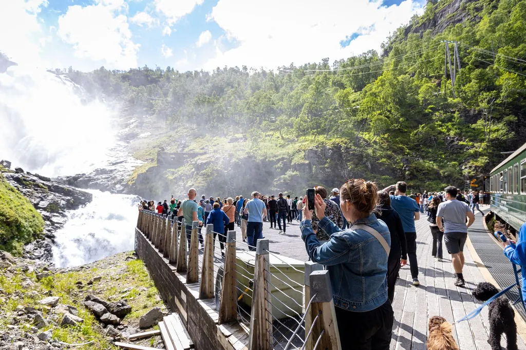
The stop at Kjosfossen: five minutes at the waterfall
Kjosfossen is 225 metres high and falls in several steps from the lake Reinungavatnet, finally into a tunnel under the track. The stop has existed since 1951 for the sole purpose of letting passengers get off and look. The train waits for five minutes. When there is a lot of water, you get wet on the platform.
Next to the waterfall there is a power station. It uses the water from the high mountains and supplies, among other things, the electricity for the Flåm Railway.
Honestly: Five minutes is short when a full train wants to get to the railing at the same time. Anyone travelling in a wheelchair loses out here: according to the operator the stop is not wheelchair accessible, and the waterfall cannot be seen from the carriage with the wheelchair spaces.
Kjosfossen to Myrdal: turning tunnel and horseshoe
The section beyond the waterfall was the hardest of the entire construction. To spread out the gradient, the engineers built a tunnel that turns through 180 degrees inside the mountain. From inside a snow shed you look down the Flåmsdalen once more on the right, and straight afterwards through a gap in the rock on the left.
Then you are on the Reinunga plateau, by the lake that Kjosfossen comes from. The Kjosfossen and Reinunga stops are only 400 metres apart as the crow flies – on the track it is more than two kilometres. A second 180-degree turn follows, this time in the open air, up to Vatnahalsen. There, two levels of the track lie almost vertically below you.
The last few minutes to Myrdal run almost entirely through tunnels and sheds. Myrdal itself lies between two tunnels of the Bergen Line.
Flåm Railway: which side to sit on?
The operator makes no recommendation – and its own description of the line makes clear why: the view changes sides several times. On the way up it goes like this:
| Section | What | Side going up |
|---|---|---|
| after the first valley crossing | Mountain farms Ryo, Holo, Geisme | left |
| after Berekvam, second valley crossing | Gorge, view of Kårdal and Kårdalsfossen | right |
| after the turning tunnel | View from the snow shed down the Flåmsdalen | right |
| shortly afterwards | View through the gap in the rock | left |
| Kjosfossen | Waterfall | get off |
Which side Rjoandefossen is on, the operator does not say explicitly – only “on the other side of the valley”. So we are not going to guess.
Rule of thumb: If you ride up and back down again, you see both sides anyway. On the way down, sit on the same side relative to the direction of travel as on the way up – then you look at the other side of the valley.
The operator does not mention fixed seats for individual travellers; it only promises reserved seats to groups of ten or more. There are no classes.
Down the line on foot or by bike
Beside the track the Rallarvegen leads down into the valley – the old construction road from the days when the Bergen Line was built, now a walking and cycling route. You cannot get lost: there is only this one way down. The operator reckons on four to six hours on foot from Myrdal to Flåm and two to three hours by bike. The steepest part is right at the top, around 3.5 kilometres to Kårdal; the operator itself recommends walking it and only getting on the bike at the bottom.
Honestly: For this you only need a single ticket up – but half a day and dry weather. With a few hours in port, leave it.
What the ride costs and how to book is under Flåm Railway tickets. Timetable, getting there and the question of whether it is worth it are on the main Flåm Railway page; if you are arriving without a tour, read Flåm Railway on your own.
Where the figures come from
| Item | Source | Checked |
|---|---|---|
| Description of the line, views left and right, 55 ‰, curve radius 130 m, Nåli tunnel, turning tunnel, Vatnahalsen | Flåmsbana AS – Description of the line | 21 September 2026 |
| Stations: Lunden, Håreina (church 1670), Berekvam (passing loop), Blomheller, Kjosfossen (225 m, stop since 1951, power station), Reinunga (400 m as the crow flies), Myrdal | Flåmsbana AS – Stations and stops | 21 September 2026 |
| Elevations and kilometres of all stations | Bane NOR – station pages (Myrdal, Flåm and intermediate stops) | 21 September 2026 |
| 20 km, 20 tunnels (18 by hand), 5.5 % on 80 % of the line, built 1923–1940, 5-minute stop | Norway’s best – The Flåm Railway round trip (in German) | 21 September 2026 |
| Journey time, request stops, wheelchairs at Kjosfossen, group seats, walking and cycling time, 3.5 km to Kårdal | Flåmsbana AS – Frequently asked questions | 21 September 2026 |
Image credits
- View from the train: Karen, CC BY 2.0
- Stop at Kjosfossen: Superbass, CC BY-SA 4.0

